For several years, I have tinkered with the idea of doing a Grand Randonnée in the national parks of southern Utah. A Grand Randonnée has the minimum distance of 1200 km (750 miles), over a 90-hour time period (just over 3-1/2 days). During the fall and winter of 2013, I begin working on some routes. I wanted the riders to be able to visit one national park (or monument) each day — hopefully daylight hours too. I mapped out literally dozens of routes on Ride with GPS, and finally settled on this one. During the early part of 2014 I got it approved as a RUSA “permanent” which means can be ridden any time and not on a scheduled day. It is called the Red Rocks Randonnée 1200.
My intent was during the 2014 season, to ride two 1200Ks (celebrating the fact that I just turned 60). I was hoping to ride this one during the spring of 2014, but couldn’t find enough others to join me. During this time, Jim Halay, a resident of Eden Utah and a member of Salt Lake Randonneurs, a group I manage, needed a 600K ride to qualify for a 1200K coming up. So I decided to quickly design a 600 km shortened version of this route and then just do it. We were joined by none other than Debra Banks, a very active randonneur (or randonneuse to be exact) from Sacramento. She is also the designer/owner of Rivet Cycle Works, which makes some killer suspended leather saddles. (Read her blog report of this ride here.)
Finally, on June the 3rd (2014), at 4 a.m. we started off, leaving our motel in Kanab Utah (elevation 4,953 ft, very near the southern border of the state). This was a self-supported ride. The local temperature was in the upper 60s, so most of us wore minimal clothing as we heading south towards the Arizona border. After less than eight miles we were in Arizona and the temperature was dropping to the upper 40s. Rather than stop and add layers, we just kept riding, toughing it out. After 50 cold miles, we came to our first checkpoint in Apple Valley, a Chevron c-store. We immediately stepped inside to the warmth of the building and consumed some breakfast foods. The sun was just rising over the bluffs to the east.
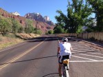
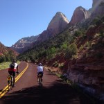
Staying together as a small group, we proceeded on our way, dropping in elevation to the low point of the ride, which was in Hurricane Utah, elevation 3,248 ft. The forecasted high was in the upper 80s or low 90s, but it was still early morning so we were not feeling the heat of the day yet. We climbed out of Hurricane up to Springdale and through the entrance to Zion National Park. Our route continued along the valley floor, with spectacular views of the red canyon walls, some 3,000 feet tall. Our route ended at the end of the road, which is called the Temple of Sinawava. This location is also the exit point for those walking up the Virgin River doing the legendary Zion Narrows. We topped off our water bottles and reversed our route, dropping in elevation as we followed the Virgin River downstream along Highway 9.
We then started climbing in earnest as we got on and off I-15, heading north to Cedar City. At one point, Deb and I stopped under a freeway overpass to cool down as we waited for Jim. He arrived and kept on riding past us. After finishing our conversation (mostly trade talk stuff) and topping off our internal radiators, we continued the climb, hoping to catch Jim. As it turns out, he pulled off in Cedar City to rehydrate and the two us, having stopped earlier, unknowingly went past him. The three of us later regrouped at another c-store at the north end of Cedar City. From there we continued north and finally got off the interstate for the last time and onto SR-20 for the final climb of the day. This climb was approx. 1,700 vertical. The grade was not steep, but continuous. Deb and I grabbed a third bottle of water at the last checkpoint and carried them along with us for this anticipated climb in the late afternoon heat. The climb topped off at 7,863 feet, just as the sun was beginning to drop near the horizon. That was at mile 208 for the day. We made a quick descent down to US-89 and then eight flat miles into our overnight destination in Panguitch at mile 229.
Jim and I drove through Panguitch the prior day, on our way to Kanab. While doing this, we left off some drop bags with our overnight supplies at our designated motel at the Owen’s Travel Center (truck stop). I choose this location for the overnight stop because it is the only spot in the area a with 24/7 c-store. Deb, on the other hand, overnighted a FedEx box of supplies for herself to this location. We arrived at around 8:30 p.m. We knew that the pizza place next to the motel closed at 9:00 p.m., so we went directly there, instead of checking into our motel. After a much-needed supper, we checked into our motel and decided to resume our ride at six the following morning. The elevation at Panguitch is rather high at 6,600 ft.
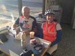
The three of us ate breakfast (from our drop bags mostly) and heading out into the chilly air. It was 29F, but we bundled up well, unlike the previous day. This part of the route takes in a few rollers, before making a 1,100-foot climb to the east, up a nicely paved bike trail. From there it heads south, climbing again, towards Bryce Canyon National Park. Before the entrance we stopped at Ruby’s Inn General Store. Compared to the Panguitch truck stop/c-store, this was a super-market, with many choices of groceries and food. Most of grabbed some sort of frozen “delight” and microwaved it and then we sat on the south-facing benches of this store, enjoying the warming rays of the morning sun.
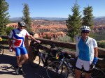
From Ruby’s Inn, we made our way into the park and visited several lookouts, some of which were on the cue sheet and some that were not, doing some recon for future brevets. Unlike Zion, in Bryce you are looking down into the canyons and riding along the top of a ridge inside this beautiful park. The early morning light provided great views of the many hoodoos in this park (sandstone spires). Finally, after exiting the park we proceeded back down to highway 89 and headed south towards Kanab, generally loosing elevation, but into the typical prevailing SW wind.
We later stopped in the small town of Hatch, finding a decent c-store (news to me…will be noted on future cue sheets) and then kept on going towards Mt Carmel Junction, which is near the eastern entrance to Zion. After grabbing supper at the local Subway (mile 337), we made another climb up to the junction to Coral Pink Sand Dunes and headed south to this state park, leaving busy highway 89. My shoes, which were some two months old, were giving me issues and I had developed a nice blister or callous spot on my right pinky. These shoes were a tad too narrow and so I had them loosely buckled, causing my foot to slide forward, making matters worse. I finally took an unneeded arm warmer and stuffed it under the buckle, as I had the buckle tightened all the way, but the shoe was still too loose. This helped a lot, but the damage was done. After more climbing and a short descent, we arrived at the state park. There was water and restrooms there which we needed as we were now in the later afternoon heat of southern Utah.
Soon, we realized that we had only approx. two hours to finish this ride and had 20 miles to go. This permanent must be finished in 40 hours or it is considered a DNF. We left briskly and made a u-turn, and after a short climb, we were rewarded by a quick descent on a rather rough, patched and potholed paved road (Hancock Road) back down to US-89. I am glad it was daylight, as I would not want to be descending this crappy road in the dark! But at least there no traffic along this section of road. We then had some easy gradual downhill miles back to our motel in Kanab, arriving with only 45 minutes to spare. Our generous sleep stop and side trips in Bryce Canyon really cost us time and nearly cost us the whole ride!
My GPS/Strava download indicated a little over 17,000 feet of climbing. A few seasons ago, I did the Grand Canyon 600, which had approx. 20,000 feet of climbing and also had similar wild temperature variations (from 33F to 95F). This one rates up there as “one of my toughest 600s.” When designing the route, I actually tried and tried to reduce the climbing, but simply couldn’t do it without cutting out one of the parks and diluted the very essence of this route. Afterwards, we stopped by a local BBQ restaurant to top off our tanks once again. Deb spent the night in Kanab and Jim and I made the drive home, stopping a few times for truck-stop cat naps.
Meanwhile, it will be impossible for my tiny RUSA region to support a full-blown 1200K, unless it is essentially a self-supported event, which means no meals at the overnight stops. This could be a problem as neither of the two key central cities on this route (Panguitch and Kanab) have any 24-hour restaurants, only 24-hour c-stores. The 1200K Red Rocks route has about 30,000 feet of climbing. This is not be the toughest 1200 out there, but it certainly rates high. Consequently, I am rethinking the whole thing. I have now designed a new 1000K route and may try to do this in the fall of 2014 as a permanent. I’m seriously considering adding three ACP “Red Rock” choices for the 2015 season — a 400, 600 & 1000, all starting at the same time and date and roughly following the same route.







This ride sounds like a lot of fun. The difficulty of doing a Grand in Southern Utah will always be the temperature deviation and elevation. Great ride! I would be very interested in the development of a series.
LikeLike
A 1000K about a month before PBP, or really anytime, would be a real draw–at least, a fantasy ride for East Coast randonneurs. Good luck with developing these rides.
LikeLike